As you might have worked out by now, I am a very observant person and it isn’t just limited to trains, if my experiences up in the Snowy Mountains are anything to go by.
These two types of signs can be found all around the region, at least if you are an engineering geek like me. Related to the Snowy Mountains Hydroelectric Scheme: the green signs are usually found beside roads with the arrow pointing towards locked gates across dirt access tracks, while the red signs are affixed to random pipes and concrete boxes throughout the countryside.
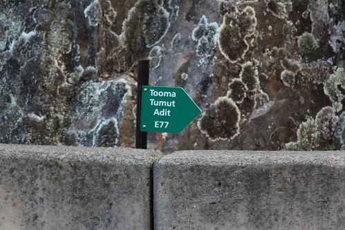
This first sign pictured is located near Tumut Pond Dam, the text reading:
Tooma Tumut Adit
E77
The Tumut River was behind me, the Tooma River some distance to the south, and an adit is a horizontal opening to an underground mine or tunnel. I’m assuming the arrow points towards a service entrance the Tooma-Tumut tunnel, which carries water from the Tooma Reservoir to Tumut Pondage, where it is used to generate electricity in the Tumut 1 power station.
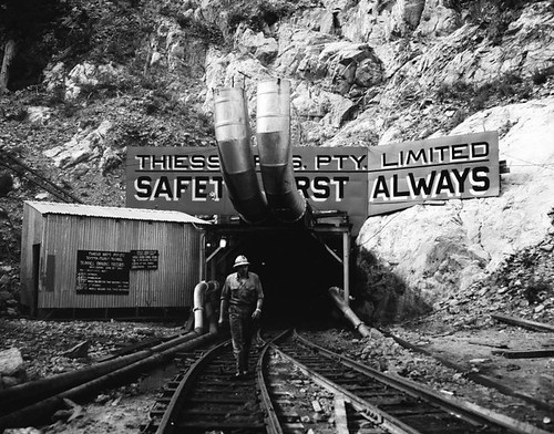
The 14 kilometre long, 3.43 metre diameter Tooma-Tumut tunnel and the associated Tooma Dam were constructed by Thiess, who were the first Australian firm to win a major construction contract on the Snowy project. Completed in 1961, during the construction period a world tunnelling record was set when 526 feet (160.3 metres) of tunnel excavated in a six-day week. This 1960 photo shows one of the tunnel portals: was it the one I was standing above?
This second sign reads:
Eight Mile Ck Aqueduct Diversion Structure
Ch: 1349ft / 411m
Located near the Tumut 2 underground power station, it is affixed to a concrete weir into which a small creek flows. From the diversion structure the water disappears underground, funnelled through turbines located deep underground to generate electricity.
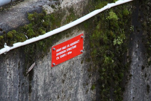
The mysterious bit is the “411m” distance measurements on the sign – it isn’t an elevation, as the weir is approximately 850 metres above sea level. A nearby vent shaft has “405m” marked on it, which suggests that the “ch” stands for chainage – the linear distance from a start point. Assuming the Tumut 2 power station is the start point for these measurements, what does the rest of the Snowy Mountains Scheme use as their datum? Unfortunately I can’t work that out without engineering drawings, or more data points. Bugger!

Leave a Reply