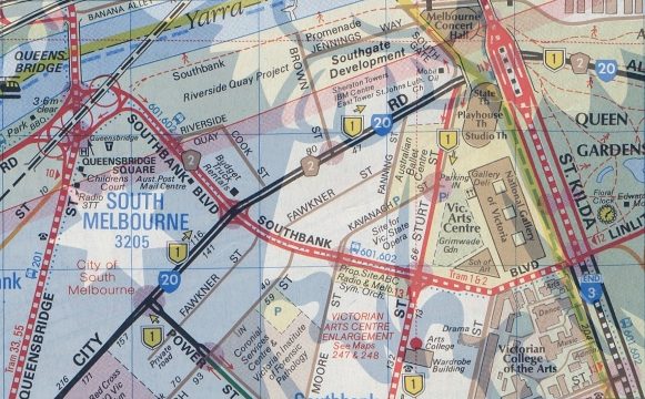
The streets of Southbank have a long and complicated history, but the most confusing is Southbank Boulevard – a creation of the 1980s Melbourne. So how did the road come into being?

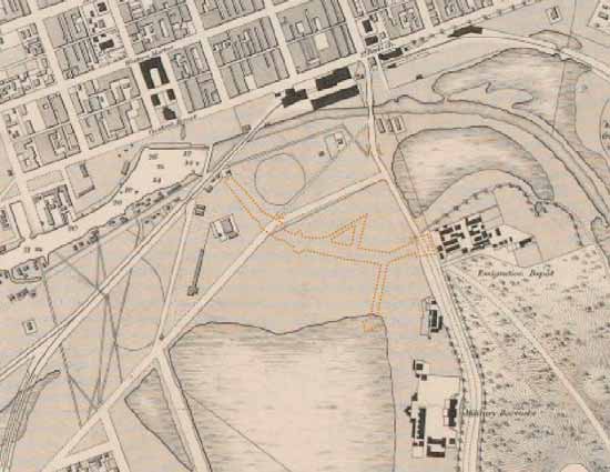
An inspection of map 43 of Melway Edition 1 shows a completely different road layout existed through Southbank back in 1966.

And on the ground, a ‘Formerly Nolan Street’ sign marks the St Kilda Road intersection.

Google Street View 2019
But help is at hand – in 2015 the City of Melbourne commissioned an ecological, heritage and cultural place assessment covering Southbank Boulevard and Dodds Street.
The current path of Southbank Boulevard commences at St Kilda Road and follows a route south-west to a point just before the Yarra bank at the site of the Falls and Queen’s Bridge.
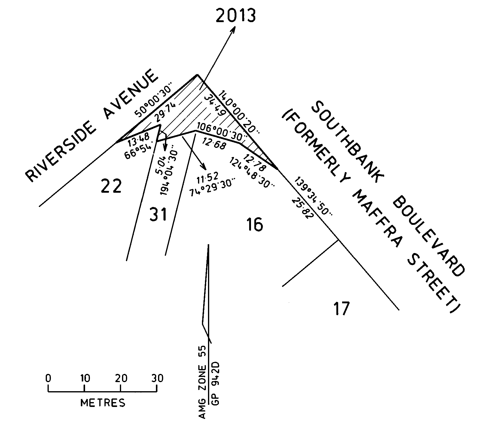
It corresponds with the former route of Nolan Street, which was formed in 1888 in gazetted in 1895). It then crosses a path parallel with the former route of Ireland Street (formed by 1886) but at a point just north of Ireland Street, before following the route of what was formerly Maffra Street (gazetted in 1895).
Henry Cox’s map of Melbourne dated 1865 shows the absence of development in the area.
Extract from Henry Cox’s map of Melbourne dated 1865
But by 1879 the land had been drained, with industrial complexes and warehouses being constructed on the land.

Extract from 1879 map of harbour works to be undertaken by Melbourne Harbour Trust
Being fully developed by the time this 1931 aerial photo was taken.
1931 aerial photo, via Land Victoria Historic Aerial Photography Library)
The St Kilda Road end had been beautified by the 1960s.

1967 photo from the Laurie Richards Collection, Item MM 54017, via Museums Victoria
But the rest of the area was still industrial.

1960 aerial photo, via Land Victoria Historic Aerial Photography Library)
Including the banks of the Yarra River, where the Sandridge Bridge carried the Port Melbourne and St Kilda railway over Maffra Street.

But the road layout remained the same until the 1980s.

Bur change came following the conversion of Swanston Street to a pedestrian mall.

The decision being made to join Nolan and Maffra Streets in South Melbourne to create an alternative thoroughfare for city-bound traffic when Swanston Street was first closed to traffic.
The 1987 Melway shows the proposed road as dotted line.

And by the 1988 edition more detail was included, including Southbank Boulevard as a dual carriageway, and associated closures of side streets.

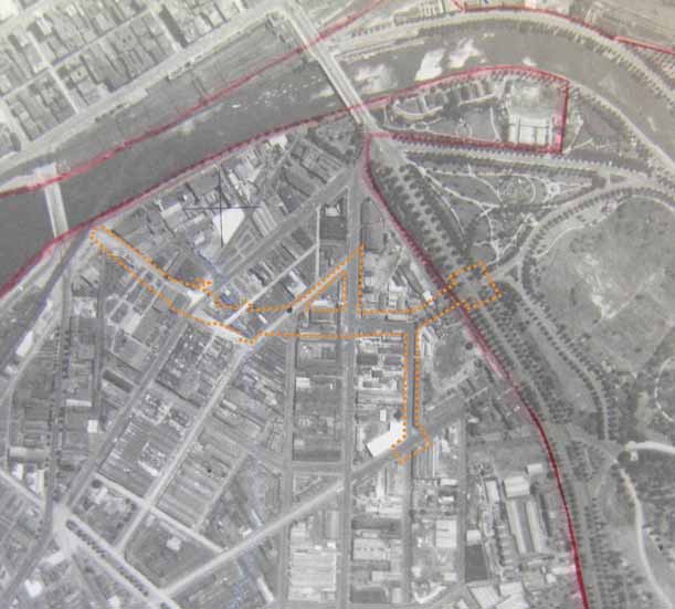
The swathe carved through South Melbourne by the completed road is visible in this 1989 aerial photo.

1989 aerial photo, Land Victoria Historic Aerial Photography Library
With the 2015 heritage statement listing the buildings cleared for the road.
The Melbourne and Metropolitan Board of Works (MMBW) plan of 1896, shows that the new section of road cut through the courses of Bridge Street (the remainder of which is now Fawkner Street), Kavanagh Street, Moore Street and Sturt Street, and that in the intervening blocks is overran the premises of several industrial premises, including most substantially the following:
- ‘Stone works’ between City Road and Bridge Street;
- ‘Cork works’ between Bridge Street and Kavanagh Street; and
- ‘Engineering works’ (exact type not specified), including rails for trams and a travelling crane.
During its first few years of operation, up to 40,000 vehicles a day used Southbank Boulevard – compared to the 50,000 vehicles per day that currently use Kings Way.
As Melbourne continued to reorientate itself towards the Yarra River with the redevelopment of Southbank, the railway viaduct across South Melbourne was demolished in 1993, leaving just a stub of the Sandridge railway bridge behind.

Opening up the intersection of Queensbridge Street and Southbank Boulevard.

And the land on the western side of Queensbridge Street was turned over for the construction of Crown Casino.

In 1996 questions were asked as to what purpose Southbank Boulevard served.
Mr Batchelor (Thomastown)
I raise for the attention of the Minister for Planning and Local Government the relationship between the CityLink Southgate interchange and the proposed Queens Bridge square, and the impact of these two developments on traffic flows.
In particular, the opposition wants a guarantee that drivers will have options other than ending up in the casino car park. The Southgate interchange has already been dubbed Spaghetti Junction, but despite that confusing,complex and ugly structural monstrosity, it is clear that its prime traffic function is to deliver thousands of cars a day to the back door of the casino.
The opposition seeks from the Minister for Planning and Local Government an assurance that all traffic options will continue to be available; that there will be adequate capacity for all cars travelling in the variety of directions that they need to; that additional capacities and directions will be available to cars so that they will have other options available to them other than ending up in the casino car park; and that they will be able to exercise those options.
It is not just a question of direction but also capacity, particularly when one is travelling along Power Street and turning left into City Road. The traffic lights at the intersection must allow for a sufficient volume of cars to make left-hand turns into City Road so that they are not forced to travel back to the CityLink.
With the government stated Southbank Boulevard was more than just a road into the Crown Casino car park:
Mr MacLennan (Minister for Planning and Local Government)
The honourable member for Thomastown raised a matter regarding the traffic management in areas in the City of Melbourne to the south of the Yarra River.
The casino site was chosen because of the elements of traffic to which the honourable member referred. Why would one have a casino on that site? Because it provides the opportunity of having a number of roads coming to the 2500 car parking spaces that the casino was required to build as part of the project. Naturally with 2500 spaces one would expect that there would be a lot of traffic movement towards them.
Indeed, casino legislation passed by Parliament with the support of the opposition requires the construction of a car park entrance in the Queens Bridge square area, which will lead in part to the casino car park. The casino legislation passed by Parliament requires certain other traffic measurements to be taken.
And flagged that the land beside the river could be turned into a public square.
Mr MacLennan
We are examining the creation of a Queens Bridge square -it will not be a square but more like a circle – to enable the Southbank Promenade to be extended further down the river.
It will not be possible to avoid pedestrian traffic at a level where trams and motor traffic cross Queens Bridge. It has been considered whether pedestrians could go under the bridge, but unfortunately it would mean they would have to be barricaded off from the water of the Yarra River. Therefore we are examining an alternative route going over the bridge, thereby avoiding clashes with trams and car traffic.
As part of the proposal for an appropriate treatment for the Queens Bridge circle, it may be that post-CityLink Southbank Boulevard does not continue through that area, so that the circle area will become a space dedicated to people rather than cars and traffic.
Crown Casino opened in May 1997.

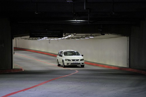
With an entry to the car park leading off Southbank Boulevard.

Via a long underground tunnel.
The end for Southbank Boulevard finally came in 2001, when the city connection was closed to make way for Queensbridge Square and the Freshwater Place development.

Atop the car park entrance the ‘Red Stair’ amphitheatre by Marcus O’Reilly Architects was completed in 2005.

Followed by the reopening of the Sandridge Bridge for pedestrians in 2006.
.jpg)
With traffic along Southbank Boulevard down to 13,000 vehicles a day following the closure, in 2015 the City of Melbourne unveiled an even more radical proposal – converting the unused road space to parkland.
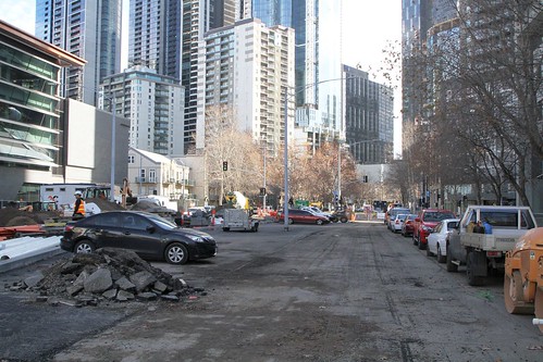
Worked started on the Transforming Southbank Boulevard project in 2018, with work due to be completed by 2020.
Further reading
Southbank Boulevard and Dodds Street: Ecological, Heritage and Cultural Place Assessment by Context Pty Lft for the City of Melbourne, October 2015.
And a technical footnote
The section of Southbank Boulevard between Queensbridge Street and Riverside Quay formally closed on 30 April 2002

While the section between Riverside Quay and City Road was rescinded as a main road a few days later on 9 May 2002.


This is fascinating. Thank you for putting up this history of a road that shapes both my personal and work lives.
Glad you enjoyed the read. 🙂
I’d forgotten about Maffra Street, which was where the Australia Post mail sorting centre was built at huge cost and demolished not so long after.
Replaced by the Melbourne City Mail Centre on the corner of Spencer and La Trobe streets, opened in 1989 and closed in 2003?
https://www.theage.com.au/national/last-post-for-the-mail-sorters-of-spencer-st-20030413-gdvjb1.html
It was actually April 2002 when city connection was closed
opps see had date city connection closed in footnotes