Years ago I was wandering through paddocks of Rockbank photographing trains, when I came across an odd sight – a ‘Road Closed’ sign hidden in the grass near the intersection of Hopkins Road and Greigs Road. So how did the road come to be?

Going back to the gold rush
A check of land titles in the area suggested that the roads once connected.

And when I turned to the Melway, I got another clue – ‘Historic Display – Cobbled Roadway’.

I looked it up on the Victorian Heritage Database – H7822-2334:
The site consists of a representative sample of the most intact section of a former alignment of Greigs Road. This section of road is 120m long and 4m wide, although the cartilage of the listing is 20.5m wide to match the width of the delisted section. The track includes a slightly raised embankment, approximately 0.2m above the surrounding floodplain, cobbled road surface and road edging.
And learnt that Greigs Road dated back to the gold rush.
Prior to the 1850s inland travel was generally along cart tracks but, following the gold rushes, the road to Mount Macedon and Ballarat was a busy thoroughfare of diggers passing on their way to the goldfields and was one of Victoria’s most important inland roads.
Swamp land around Rockbank made the route along Greigs Road the most practical early route to the Ballarat and later Blackwood (Ballan) diggings.
The route followed the Greigs Road alignment (at that time known as Exford Road) and across Strathtulloh property to Toolern Creek, then south to the Werribee River crossing at Exford. From here it went along Exford Road to rejoin the main road at Ballan.
This section of road was once part of the Greigs Road alignment but, following realignment of Greigs Road, is now part of the Meskos Road reserve.
With a 2013 report on Rockbank’s cultural heritage detailing the early years of European settlement.
William J T Clarke obtained a Special Survey of 140 square miles with a right to depasture stock on an equivalent area of Crown Land in 1852.
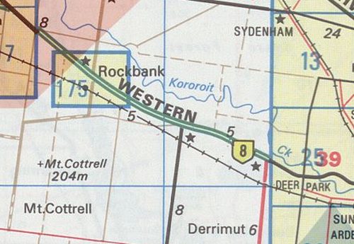
The initial survey’s were conducted by Wedge and Darke in about 1838, defining the country into a regular grid of 640 acre blocks (one mile by 1 mile), except where provision had to be made for natural features and existing travelling routes. Natural features are rare in this district, Kororoit Creek providing the only relief, and the previous route identified on the early plans as a track ‘from Upper Werriby (sic) and Pentland Hills to Melbourne’ ran roughly parallel to the existing highway, but about a kilometre to the north.
When the Crown Survey was undertaken, two roads were reserved to Ballarat, branching at Hopkins Rd. One became the present highway through Melton while the other went south along Greigs Road through Exford and on to the Bacchus Marsh. This Greigs Road route appears to have been the main route in the 1860s, and its exceptional width of about 60 m or three chains, was intended to accommodate droving livestock.
A major change to Rockbank occurred in the 1880s when the North Western Railway was constructed linking Sunshine to Ballarat through Melton and Bacchus Marsh. This meant the creation of a railway reserve, through the existing Crown Allotments and eventually forcing the realignment of the eastern end of Greigs Road to avoid an extra level crossing.
But when was Greigs Road realigned?
I thought the removal of a level crossing would be easy to find among railway records, but this time around I came up blank.

My copy of “Weekly Notice Extracts 1894-1994” by Alan Jungwirth and Keith Lambert came up blank, as did a check of Andrew Waugh’s history of signalling on the Ballarat line.
Was the realignment linked to the construction of the nearby interchange between the Western Freeway and Hopkins Road in 2001?
The intersection of Hopkins Road (Melton-Werribee Road) with the Western Freeway at Rockbank was improved using Black Spot Program funds in 1989 and 1991, but a long term solution to the congestion and crashes at this location is an elevated interchange. The $13.1 million interchange is proceeding. A sum of $3.30 million will be spent in 2001-02.
The interchange is expected to improve dramatically the safety for drivers travelling between the highway and Hopkins Road – the main route from Melton to Werribee.
The project incorporates a highway overbridge and a series of on and off ramps to cater for interruption-free traffic movements through the intersection. Under the proposal, Hopkins Road traffic will be carried on an overpass above the Western Freeway, linking to Neales Road West. A roundabout will be built where this elevated roadway intersects Government Road and on-off ramps installed to the freeway. Existing accesses to the Western Freeway from Deanside Drive, Sinclairs Road and Hopkins Road will be closed.
Seems that it didn’t – a check of the 1999 Melway shows Greigs Road already avoids the level crossing.

And going back further in time in the Melway doesn’t give me an answer – Map 357 didn’t appear until 1993, and the road was still in the current alignment.

Switching to the less detailed Map 255, the 1987 Melway shows Greigs Road as a sealed road avoiding the railway.

When the year before it was a unsealed road crossing the railway line.
Which matches this 1962 aerial photo.

Which suggests that Greigs Road was moved onto the new alignment in 1986, as part of the reconstruction of a dirt track as a sealed road .
And to the future
Right now Greigs Road passes empty grassland.

But will soon be part of the massive ‘Mt Atkinson’ estate being developed by Stockland.

The excavators have moved in.

With more than 4000 houses to occupy the estate once completed in about 20 years time.

Complete with a new town centre that will relocate Greigs Road for a second time.

Melton and Melbourne – you’ll be connected by suburban sprawl soon enough!

Leave a Reply