The other day a pair of advertisement for land sales on Melbourne’s western fringe caught my eye. The first was for an estate in Wyndham Vale, spruiking their residents only water park.

While a competing property developer says “don’t pay a premium for facilities you may never use”.

You’ll find the water park at ‘Jubilee‘ estate – located on the very edge of Melbourne at Wyndham Vale.
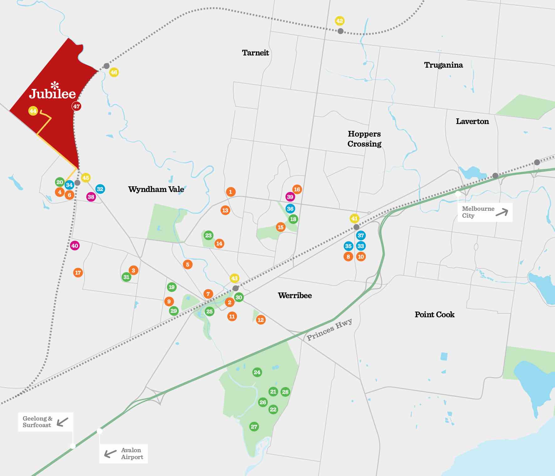
Between Ballan Road and the Regional Rail Link tracks.

The $10 million water park features water slides, a splash zone for children, leisure pool and 25m lap pool.

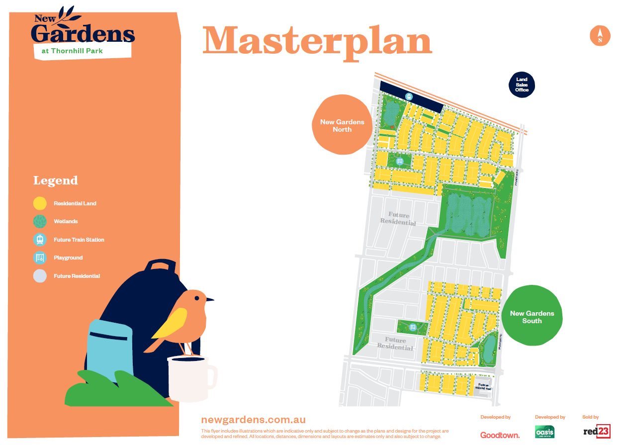
While the cheaper ‘New Gardens‘ estate is in the dirtbowl between Rockbank and Melton.
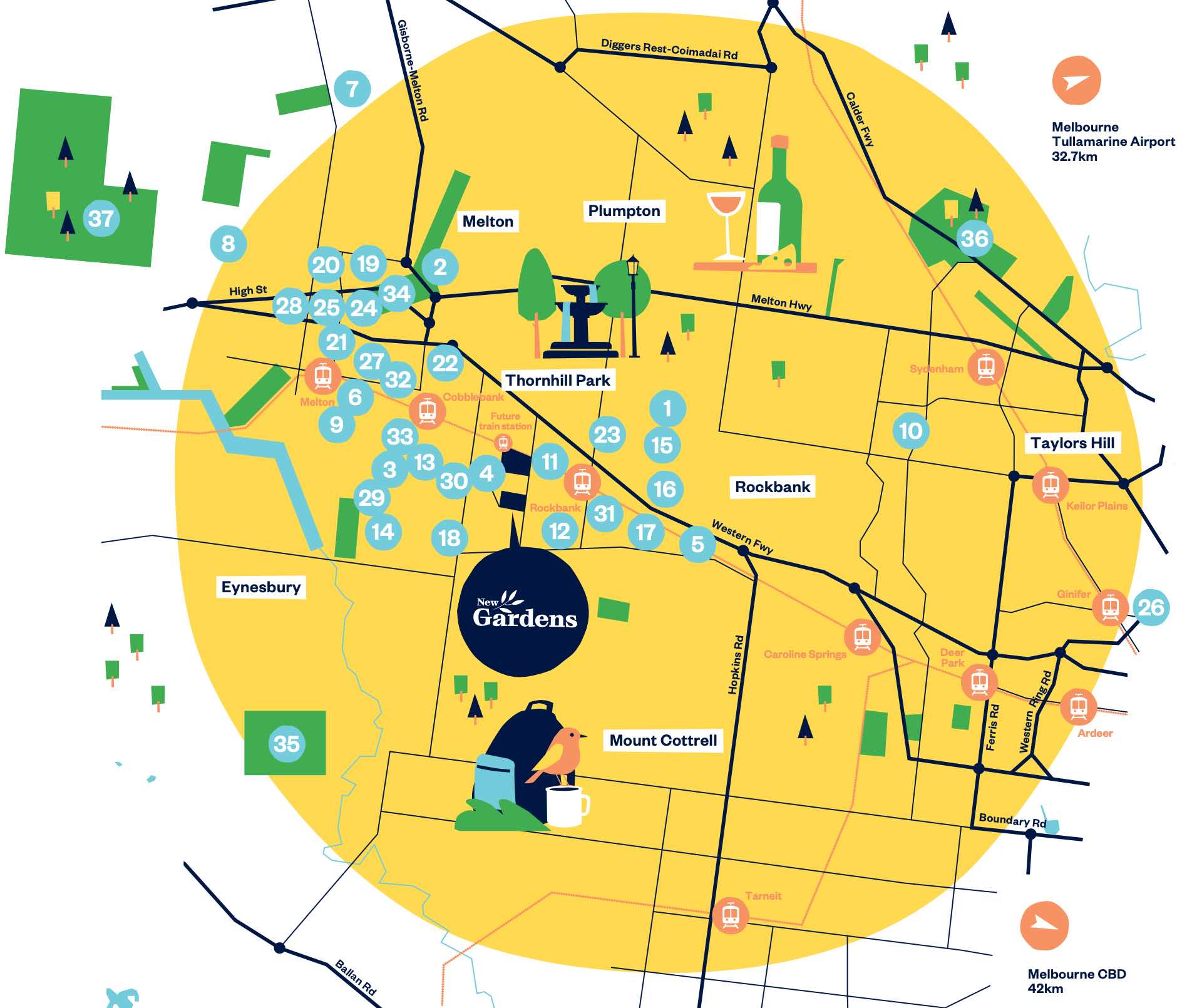
They promote a ‘future train station’ on their masterplan.
But trains won’t be stopping there any time soon – so you’ll need to drive 3.5 kilometres down the road to the recently opened Cobblebank station instead.


I wonder what happens to these facilities when the funding for them from the land purchases runs out.
Multi storey buildings that pools, gyms, etc have an owners corporation to manage the common areas – with owners of each apartment needing to pay an annual fee to maintain them. Jubilee estate has the ‘Jubilee Homeowners Association’:
https://www.myjubilee.com.au/owners-corporation/
“Dirtbowl”….
Plenty of other estates being developed in rural areas that’s are similar yet you’ve never used that term before…
Why for this location??
Do you have something against Rockbank/Melton??
Paynes Road in Rockbank was a literal pile of dirt when I visited back in 2019.
https://twitter.com/aussiewongm/status/1199620093170176000
For the past 15 years I’ve been passing through the area to photograph trains and I’m sad to see it all get covered by houses – I’ll miss the open plains.
I lived in Melton for 20 years and know what you mean.
But Lara, Trugganina are similar yet never seen you call them dustbowls.
Disappointing to see the canola crops disappear!
There’ll be a station at either end of Jubilee when (if) the station at Sayers Rd gets built – as long as access to Sayers Rd across the Werribee River and the rail line is built in. And Sayers Rd is where the Western United stadium is going to be built, I think.
Interesting that proximity to train stations is as much a developer selling point now as it was 100-150 years ago! A developer map from probably the 1870s for my area in Footscray shows the railway station – would’ve been the original one on the Sunbury line west of the current one on the junction – shown just east of Victoria St so not quite in the right spot geographically (and not the original Middle Footscray – too early for that). Pre-dates West Footscray as well – but no ‘future station here’ marked!
The planned locations for future Regional Rail Link stations are marked on this map:
https://raildocs.wongm.com/regional-rail-link/Regional-Rail-Link-additional-station-locations-DPCD-report-2009.jpg.html
I’ve also got a post in the works on Footscray’s original pair of railway stations. 😉
It took years and years for stations like Cardinia Road and Williams Landing to be built, and even then WL was shifted from Forsyth Road to Palmers Road, I wouldn’t rely on those promises at all.
The state government’s Urban Land Corporation bought the land of the ‘Boardwalk’ estate at Point Cook way back in 1998:
https://www.acnu.org/wp-content/uploads/data/Chris%20OKeefe.pdf
While Williams Landing wasn’t given the go ahead until 2010.
https://www.railgeelong.com/location/williams-landing/
So you can’t even count on a state government backed land developer to give you a railway station in a timely matter!