Truganina has been in the news a lot lately thanks to a series of coronavirus outbreaks, but there is something else notable about the suburb – it’s arguably the largest and most confusing suburb in all of Melbourne.

The confusion starts
In June 2021 a BP service station on the Western Freeway was reported as an exposure site.
New exposure site
BP Service Station- Westbound (outbound)
Address: 1789 Western Freeway, Truganina, VIC
Date: 13/07/2021
Time: 7:15am – 7:50amTier 1 – Get tested immediately and quarantine for 14 days from exposure #COVID19VIC
— VicExposureSiteBot (@ExposureSiteBot) July 17, 2021
But when you put the address into Google Maps, it shows that the service station is nowhere near Truganina – it’s north of the next suburb over, Ravenhall.
aha! so it's google maps that's wrong. pic.twitter.com/f6TRPurzJc
— ken tsang (@jxeeno) July 16, 2021
Yet Google Maps also lists the service station’s address as being in Truganina.
Google maps has it as truganina…? pic.twitter.com/3fd1U8N0JS
— Patrick Malone (@pattymalone2000) July 16, 2021
So what gives?
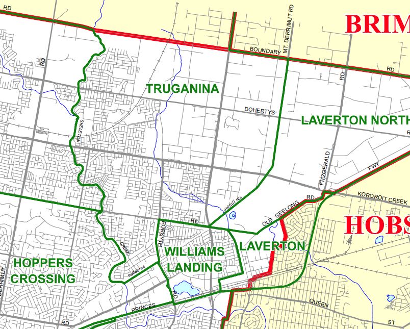
So where is Truganina?
To get a definitive answer on the suburb’s boundaries, I turned to the Victorian Register of Geographic Names. Turns out Truganina is a massive suburb, covering 56 square kilometres.

Stretching 15 kilometres from the Western Freeway, Rockbank station and the Ballarat railway line in the north.
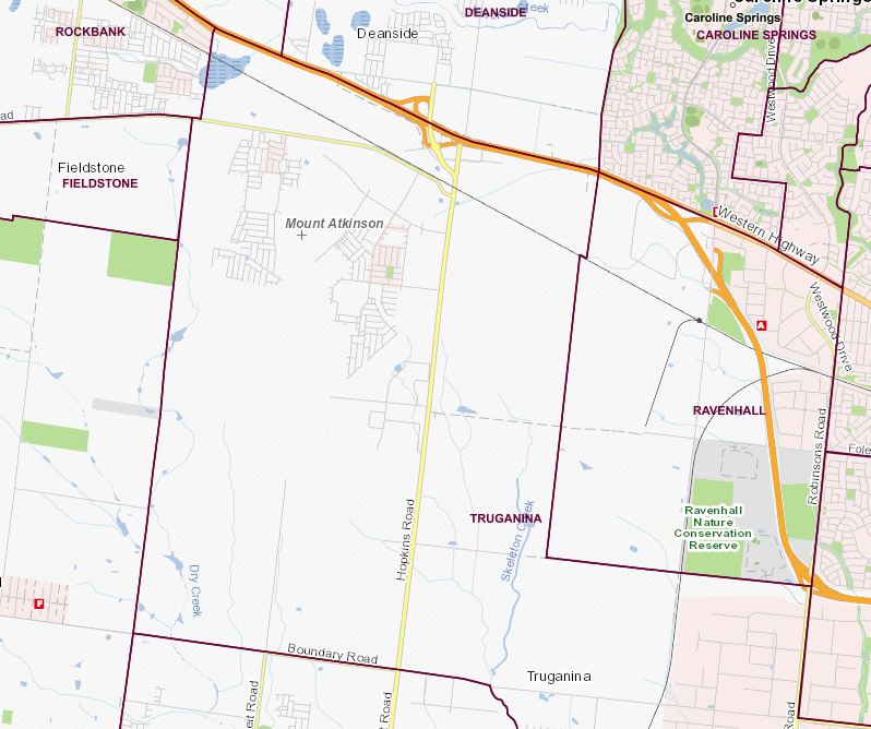
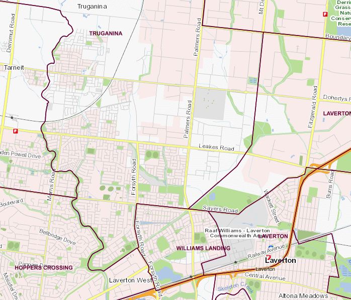
Down to Hoppers Crossing and Williams Landing in the south – almost reaching the Princes Freeway and Werribee railway line.
So time to explore!
The southern end of Truganina is cookie cutter housing estates just like any other growth area of Melbourne.
The selling point being the (relatively!) low prices for land.

And V/Line trains to Southern Cross Station, which use the Regional Rail Link route opened in 2015.

Westbourne Grammar School also has a campus here, opened back in 1977 when the area was just paddocks.

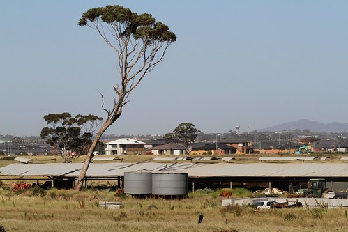
But residential development continues creeping north over what was once grazing land.
Then we meet fields of tilt slab concrete warehouses, home to over 1,500 registered business, both large and small.

Then we reach the centre of ‘old’ Truganina – the local cemetery.
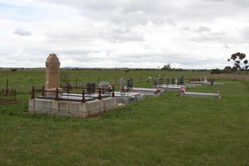
Located next door to a pony club.

Unlike Tarneit the only high ground is a handful of road-over-rail bridges, which provide a view of the Melbourne CBD, located 20 kilometres away to the east.
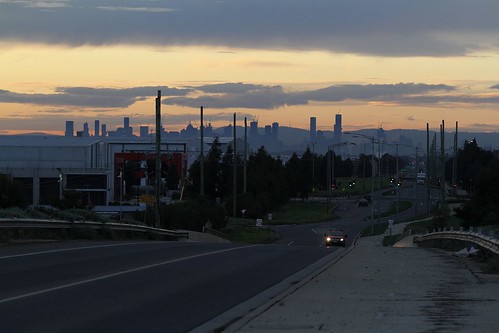
But it is massive warehouses that dominate the skyline of Truganina.

Towering over the railway lines.

The biggest being a pair of 43 metre tall automated cold storage facilities, capable of holding 225,000 pallets of frozen goods.

But hidden between them is something much smaller – the Truganina Munitions Reserve, established during the Second World War to store explosives in what was then an isolated area, but now abandoned and vandalised.

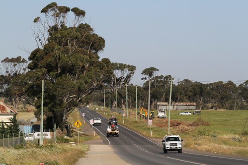
We now head out into the countryside.

A few farm houses still remain.
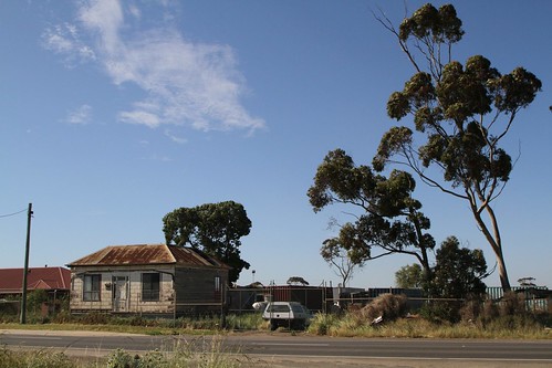
The roads now full of traffic, used by motorists taking a shortcut from the Western Freeway.
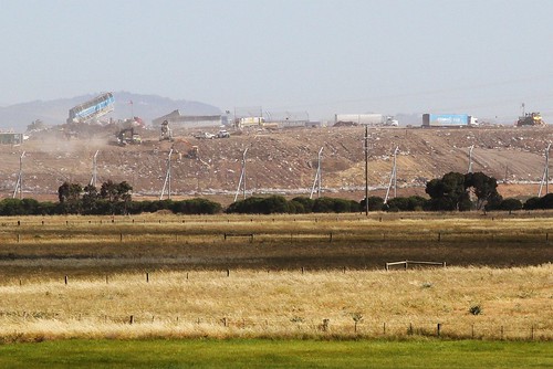
We skirt the massive rubbish tip located at Boral’s quarry in Ravenhall.
And find high voltage power lines bound for Geelong.
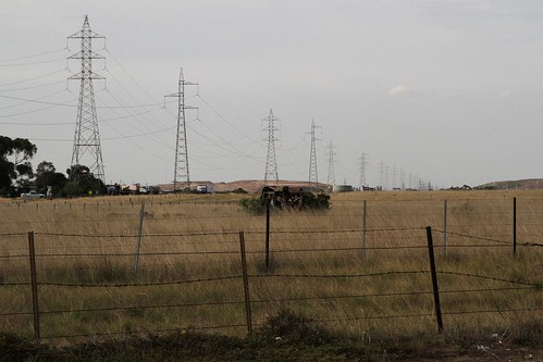
And some even bigger power lines bound for the Portland aluminium smelter.

Until we eventually reach the Ballarat railway line.

Here we find Truganina’s second front of urban development.

Moving south-east from Rockbank station.

With new houses taking shape.

On roads stained by red dirt.

Filling the paddocks between Mount Atkinson and Mount Cottrell.

Fifteen kilometres from where we started – no wonder nobody knows where Truganina is!
Footnote – border changes
Truganina falls between the City of Wyndham and City of Melton, but the name has a long history – the local post office opened on 12 June 1878, closed in 1895, reopened in 1902 and closed again in 1942.
In 1992 southern boundaries were formalised by the then-City of Werribee, with public consultation showing concern that the historic value of the Truganina, Tarneit and Mount Cottrell names may be lost if they were absorbed into neighbouring localities.

Victorian Government Gazette 1 July 1992
The boundaries for the southern half of Truganina again gazetted in 1998, and are still in place today.
City of Wyndham locality names and boundaries – Version 5.7 August 2021
However the northern boundaries in the City of Melton have seen some change, since Ravenhall and Truganina gazetted as suburbs in 2006.

Shire of Melton locality names and boundaries – Version 4.4a August 2006
The boundary being moved north in 2017, when the City of Melton created eleven new suburbs to cater for urban growth in formerly rural areas.

City of Melton locality names and boundaries – Version 4.6 February 2017
The changes were minor – but made Truganina even bigger!
The northern boundary will extend along the Western Freeway eastbound from Clarke Road to Troups Road North. The western boundary will align with Troups Road North southbound from the Western Freeway to Greigs Road. The boundary continues westbound along Greigs Road to Troups Road South, extending southbound along Troups Road South to Boundary Road.
The southern and eastern boundaries remain unchanged.
The area now being developed was added to Melbourne’s Urban Growth Boundary in 2010 following the passing of Amendment VC68.

Delivering Melbourne’s newest sustainable communities
So the failure to split out the northern half of Truganina in 2017 as a new suburb seems quite odd – it’s not like the new housing estates were a sudden change.

It’s notable that the suburb is spread over two councils. Is it a quiet battle between Wyndham and Melton about who gets to keep the ‘historic’ locality name of Truganina when it is inevitably cut up into smaller suburbs? Did Melton increase the size of Truganina in 2017 to strengthen its claim?
That’s a very good point – I’d argue that Wyndham should get to keep the name, since “old” Truganina falls inside their boundaries, and the housing estates in that half are more established.
I agree. Also the City of Melton portion has the Mount Atkinson name that, while not the official name of the area, looks set to be (at least most of) the area`s name (including the railway station).
and is it really named after truganini?
Thanks for filling that gap in my knowledge of the local area, so I should offer a few details in return:
The Munitions Reserve is very distinct from the Truganina Explosives Reserve which has its own Protection Society (TERPS) on the western edge of Altona, Surrounded by Kooringal Golf Club across Queen Street, Altona Coastal Reserve and the greatly widened Laverton Creek estuary.
The Truganina name is an interesting footnote to 19th century colonial awareness of the devastation of colonialism, especially in Tasmania, when it must have remained a lot more prescient than through the cone of silence that covered much of the 20th.
Despite its proximity and occasionally riding RRL trains or driving through unaware, more so since the Palmers Road alignment got its missing link bridge across the Kororoit east of Caroline Springs, the only time I’ve set foot in any of that vast suburb was on a final pre pandemic mission to check out the extreme SW corner of Brimbank where it is surrounded by 270° of Tarneit (Wyndham south and southwest, Melton west) with the obscure Dunes Drain touching Brimbank’s as it passes diagonally under the intersection, one of so many arterial intersections across Melbourne whose location was determined by Robert Hoddle’s choice of an origin point on the graph paper he used around 1840 to prepare the first master map of Melbourne and surrounds which became the basis for property sales from London (that other Hoddle grid).
Researching the Truganina Munitions Reserve was rather difficult – the Truganina Explosives Reserve in Altona gets all of the attention.
https://en.wikipedia.org/wiki/Truganina_Explosives_Reserve
I’ve been through that intersection many a time – Boundary Road is a relatively quiet place to photograph trains on Regional Rail Link.
https://www.google.com/maps/@-37.8106089,144.7509741,3a,75y,133.45h,83.17t/data=!3m7!1e1!3m5!1sbKCfceXadpPS36XNoWZrcQ!2e0!5s20150401T000000!7i13312!8i6656
What is also confusing is the correct pronunciation of the suburb with some saying it one way and others another. So yes, Truganina is a very confusing suburb indeed.
Punk festival at the Munitions Reserve 2010 https://stitchesinmyhead.blogspot.com/2010/05/such-is-life-festival-review.html
also Port Phillip Prison is a famous landmark
Thanks for the link – and I’d forgotten about the prison!
Bemused that Infrastructure Victoria’s update dump today terminates the Western Rail Plan at Mt Atkinson.
The Precinct Structure Plan for the area is titled “Mt Atkinson and Tarneit Plains”.
https://vpa.vic.gov.au/project/mt-atkinson-tarneit-plains/
The area north of Greigs Road should never have been changed from being aprt of Rockbank, and I think area north of Boundary Road should now be classified as Mount Atkinson. There’s no sense in Truganina being THAT large.
Agreed 100% – it’s such a bizarre situation that they made Truganina *bigger*.
It also has:
– Campbell’s wine cellar ruins and
Leake’s dairy ruins both on Skeleton creek,
– an itinerant’s cave on Dry Creek south of Dohertys RD. Apparently people stayed in it during the depression. Haven’t been able to find it despite 2 attempts. Too worried about snakes,
– Melbourne’s most obscure bike path. Runs along Dohertys Creek from Dohertys RD to Boundary Rd right in amongst the mega warehouses.
[…] Passing over Truganina. […]
[…] As well as a new 66kV / 22kV zone substation to supply the growing suburbs and industry of Truganina. […]
[…] there are still some suburbs that are far too large, such as Truganina – stretching 15 kilometres across four distinct […]
[…] out in Truganina I photographed the trashed gatehouse at the abandoned Truganina Munitions Reserve on Palmers […]
[…] And the extension of Palmers Road north from the Princes Freeway towards Truganina. […]