The other day I was reading The Age and saw a photo of scene I swear I’ve seen before, but I couldn’t put my finger on the exact location. So let’s go chase down some high voltage power lines, and see where they take us.
![]()
Nicole Cleary photo via The Age
On the trail
The massive pylons and quad bundle conductors look just like those on the 500 kV twin circuit Moorabool-Portland transmission line I wrote about the other month.

I’ve been a fan of this transmission line for years.

The lush green grass suggested dairy country around Mortlake, not the wheat fields of the Pleurisy Plains.

But there was one big clue – the pair of transposition towers in the background.
A transposition tower is a transmission tower that changes the relative physical positions of the conductors of a transmission line in a polyphase system. A transposition tower allows these sections to be connected together, while maintaining adequate clearance for the conductors. This is important since it distributes electrical impedances between phases of a circuit over time, reducing the problem of one conductor carrying more current than others.
Double-circuit lines are usually set up with conductors of the same phase placed opposite each other. This reduces the reactance due to mutual inductance; the reactance of both circuits together is less than half that of one circuit. For example, a section of a line may be (top-to-bottom) phases A-B-C on the left, also phases C’-B’-A’ on the right. The next section may be B-C-A on the left, also A’-C’-B’ on the right. Therefore, the rotation on each side of the tower will be opposite.
But would a set of transposition towers be big enough to spot on Google Maps?
And away I go
My initial theory was that the photo couldn’t be taken *that* far from Melbourne or off a main road – normal people don’t go driving for hours down bush tracks just to photograph power lines – so I made a virtual visit to the Moorabool Terminal Station outside Geelong.

My first location of note on Google Maps – a hub of activity outside Cressy, where the transmission lines were being repaired.
Six pylons came tumbling down to earth in January 2020 following extreme winds.
The outage shut down the Portland aluminium smelter, until temporary repairs were completed to allow power to be restored.
Then off across empty plains until Lismore – where I found two parallel single circuit pylons.

But this wasn’t the transposition towers I was looking for, but somewhere I’ve been meaning to visit in person – the spot where the 500 kV line crosses over the single circuit Ballarat to Terang 220 kV line.
As I continued west, the paddocks started to turn green, and I found another place I’m yet to visit – Mortlake Terminal Station.
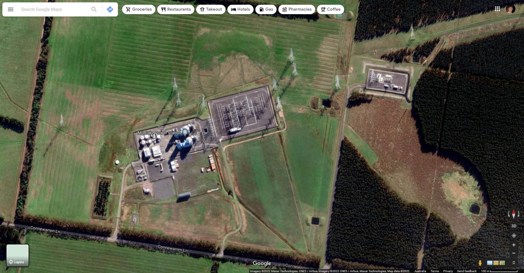
And the fossil gas fired Mortlake Power Station that relies on it.

Origin Energy photo
And finally something that matched what I was looking for – a pair of single circuit transposition towers in the middle of a twin circuit transmission line, outside the locality of Willatook.
Following Google Street View along Malseeds Road found the transposition towers.
But given the transmission line turns to the right before reaching the transposition towers, I needed to head west – Willatook-Warrong Road was the next road to take.

Now to see if it was the same set of pylons.
![]()
Nicole Cleary photo via The Age
And boom .
A match!
And one last detail
The little sign in the background of the original photo looked like a ‘Danger: Gas Pipeline’ sign, but the only gas network diagrams I could find lacked sufficient detail to confirm.

And over at Open Infrastructure Map the only feature at the location was the 500 kV transmission line I’d been following since Moorabool.
So an adventure for another day.
Further reading
Some more detail on the 2020 transmission line pylon collapse at Cressy.
- AEMO Preliminary Report – Victoria and South Australia Separation Event – April 2020
- AusNet Services cost pass through application – July 2020
- Energy Safe Victoria incident report – November 2020

Love this little search. Of interest is that the transposition structures are no longer in their optimal positions since the construction of the new intermediate stations at Tarone and Mortlake. This has resulted in constraints on generators. Ideally new transposition structures would be inserted but their cost is prohibitive. The Victorian Government’s stage 1 “South West : V4” renewable development project that will tie in both lines at Mortlake will significantly improve the situation.
I’m glad you enjoyed the search, and thanks for the extra information abut the transposition structures.