For the past decade Google has sent their Street View cars all over Melbourne, but a mate of mine recently spotted on in an odd place – going for a drive down the tracks on the Lilydale line.

This doesn’t look like a road, does it?

But in September 2019 whoever was driving the Google Street View car that day decided to head down there.

Driving from Lilydale towards Mooroolbark via the rail access track, and being overtaken by a train along the way.

But that wasn’t the only time Google drove down the access track – in May 2021 they approached it from the Mooroolbark end.

Driving through the trees.

This giant boghole wasn’t enough to stop them.

But thankfully the driver wasn’t stupid enough to drive onto the road-rail vehicle track access pad.

But soon enough the access track returned to rail level, just as a train approached from behind.
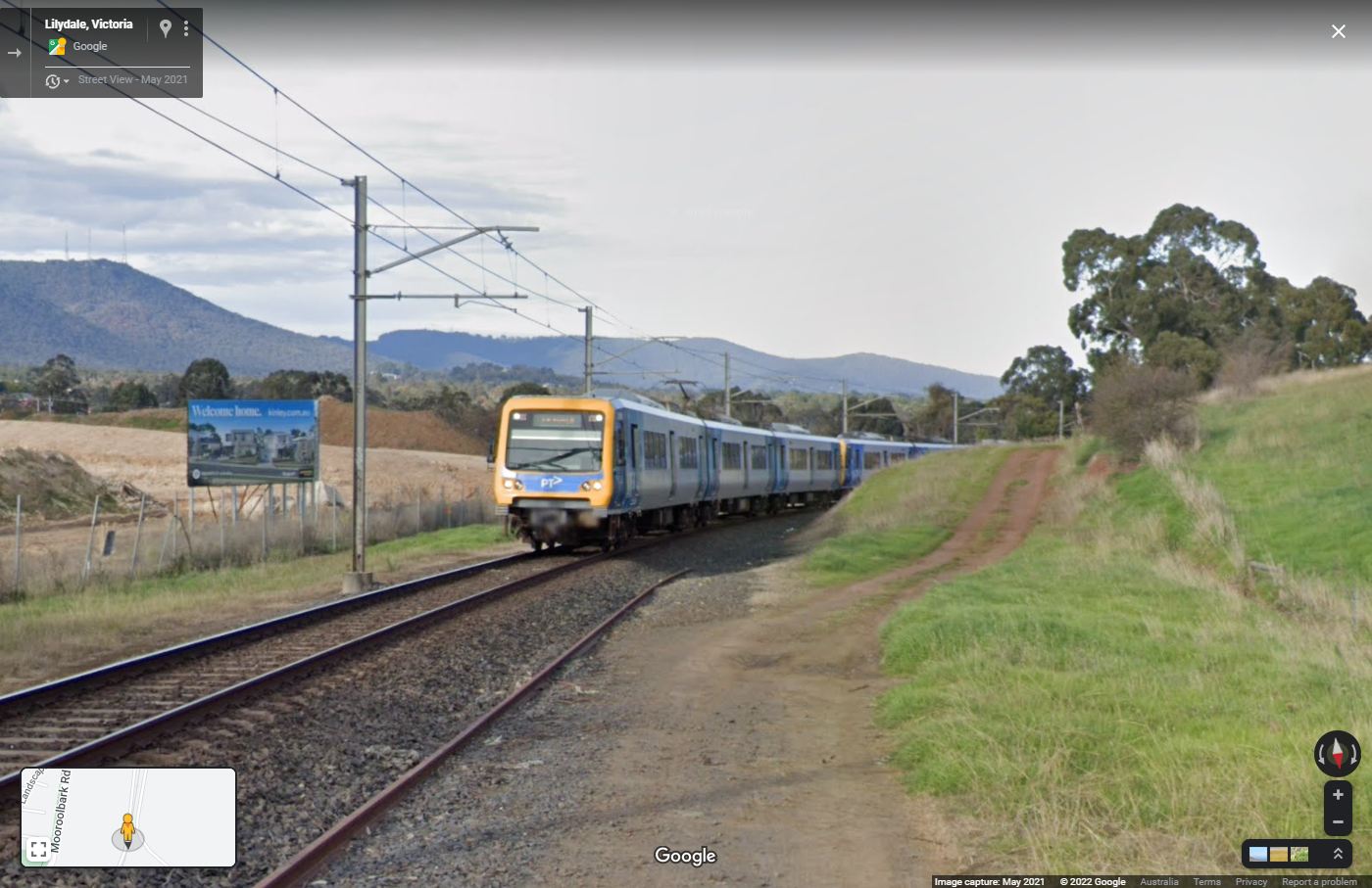
The train crept up quickly.
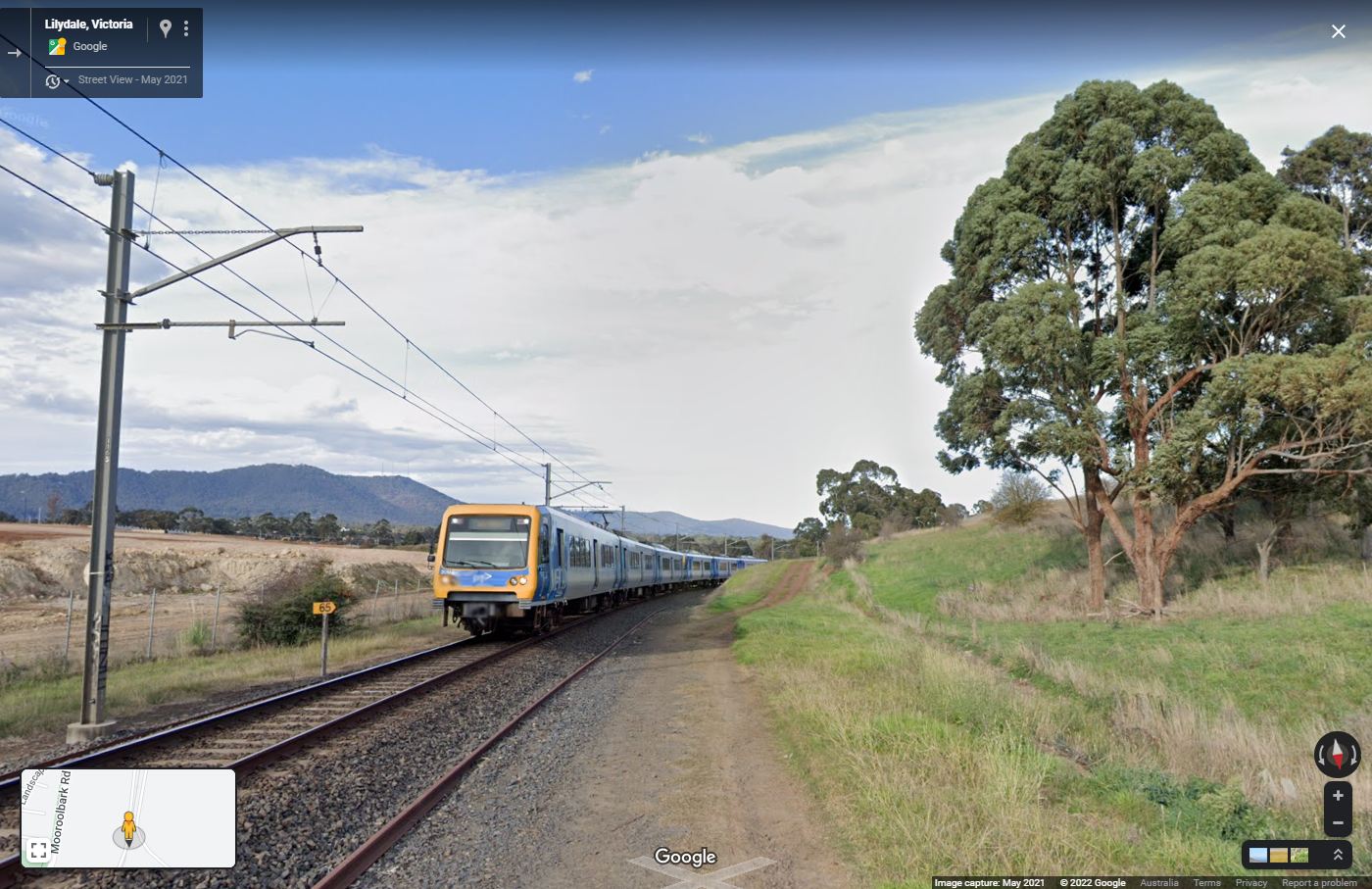
Soon level with the car.
The train slowing getting the edge.
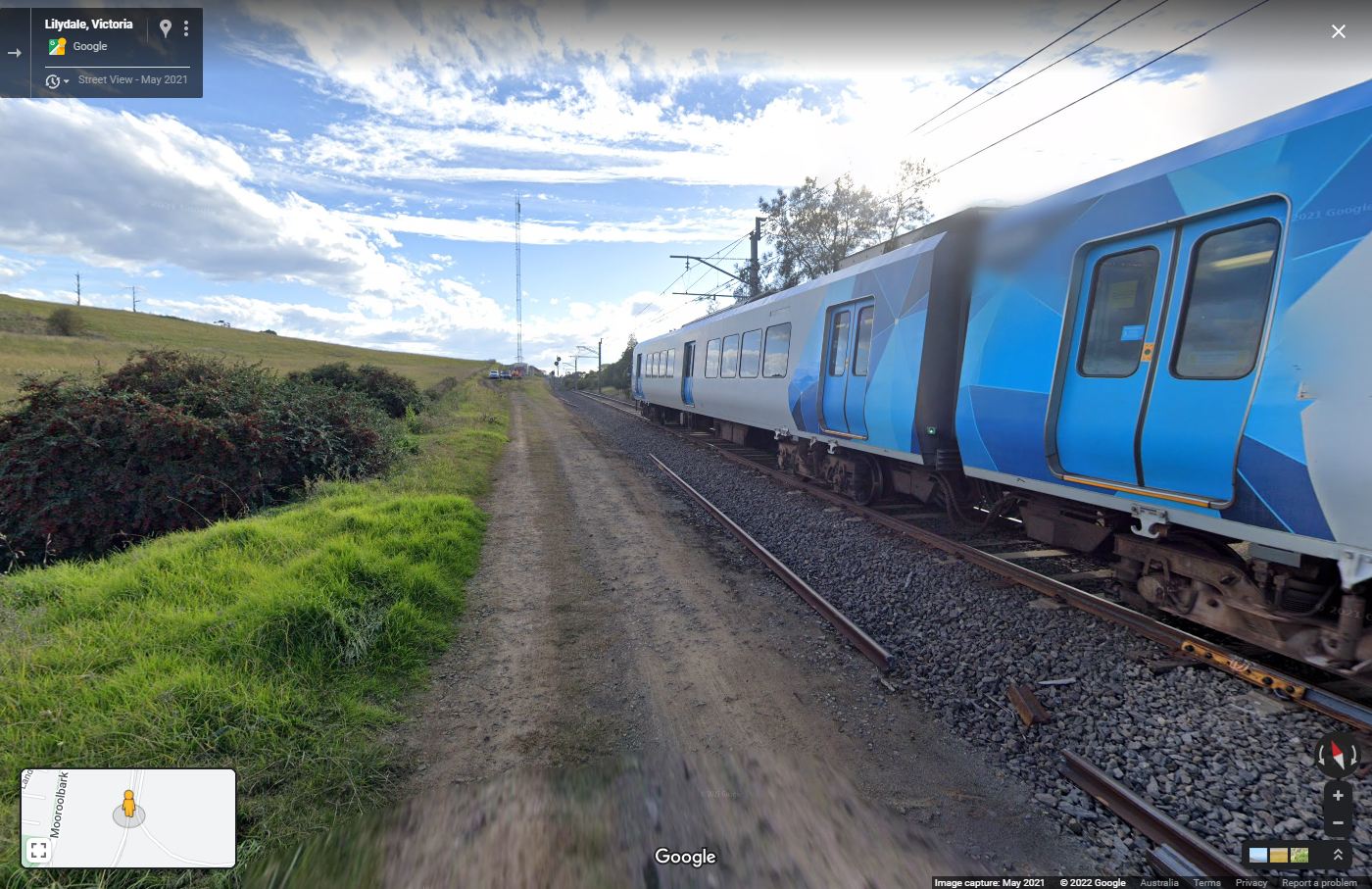
But with six carriages, it took a while to overtake.

And then it was gone.

It was also the end for the Google Street View car – today happened to be the day that a track gang was at work beside the railway line, and their cars were blocking the way towards Lilydale.

So presumably the Google Street View car had to sneak back the way it came, an embarrassed driver at the wheel.
Footnote: off for a drive
You can follow the Google Street View car yourself – here is the route it took along the railway line.

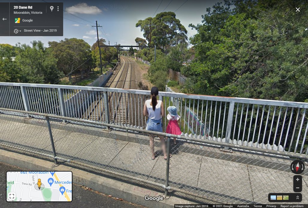
Footnote: and another Google Street View sighting
Here we see a young railfan beside the Frankston line, waiting for the next train to pass beneath the Dane Road bridge in Moorabbin.

The streetview car will not be able to run along that path again, there is now fencing at the Mooroolbark end preventing access.
There was a period around that time where Google Maps showed some railway access tracks as public roads. So their computer algorithm probably directed the drivers to drive along these corridors.
The Streetview car managed to sneak into Wagon Maintenance Depot Rd in Dynon as well.
I quite like the Comeng Cab Security Box.
https://www.google.com/maps/@-37.8079293,144.93434,3a,75y,340.5h,88.97t/data=!3m6!1e1!3m4!1sJ_dbj8W3lvqnBUO4atzmvg!2e0!7i16384!8i8192